i4sea signs new contract with Complexo do Pecém
Safety and productivity are keywords in port operations, whether in container terminals, liquid or solid bulk or port authorities in general. This is no different in Complexo do Pecém - a port and industrial complex with more than 19 thousand hectares on the west coast of Ceará.
With the contract signed in May 2022, i4sea deployed i4cast® with the mission of generating climate intelligence for the Pecém Industrial and Port Complex by generating and translating high-resolution sea&weather forecasts into operational insights.
i4cast® will support decision-making associated with the impact and risk of sea and weather conditions on operations at the Pecém Complex, aiming to increase navigation safety and operational efficiency.
Find out more details below:
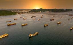
The Pecém Complex
The Pecém Industrial and Port Complex located on the west coast of the state of Ceará, about 60 kilometers of Fortaleza, occupies a strategic geographical position, with the shortest transit between Brazil, the United States and Europe.
The Pecém Complex grows with the aim of developing the local, regional and national economy by moving steel materials, fertilizers, bulk and containers. Currently, with more than 19 thousand hectares, it comprises an industrial area, an export processing zone (ZPE) and the Pecém Port Terminal - an off shore terminal with three maritime piers, for solid and liquid bulk, general cargo containerized and non-containerized.
Currently, the Complex brings together 30 companies, with more than 22 already in operation and the others in the implementation phase.
Purpose of the contract
The navigation safety and operational efficiency of the Port of Pecém depends on the knowledge of the impact of meteoceanographic conditions on marine and land port operations.
By using i4cast®, the Pecém Complex will become more productive, focusing on the following benefits:
i. Increase of cargo transported by vessels due to increased vessel drafts;
ii. Increased availability of berths with more assertive planning of berthing and sailing maneuvers.
In addition to improved response in contaminant leakage events and efficient scheduling of maintenance and deepening dredging.
i4cast® is a web and mobile weather intelligence software that aims to increase climate efficiency and safety in the maritime industry. Our mission is to support proactive, data-driven decision making, with transparency and user customization.
Different i4cast® tools will be combined to meet the demands of the Pecém Complex:
Increase in cargo transported by vessels due to increased vessel drafts.
With the global trend of increasing dimensions, and consequently, the vessel drafts, most ports in the world have restrictions on their operations. These draft restrictions are defined as a function of the local depth, more specifically, the distance between the ship's hull and the seabed - called Under Keel Clearance.
The Under Keel Clearance is a critical factor for the safety and efficiency of navigation in port areas and has a direct impact on how much cargo the vessel can or cannot carry.
Currently, several international ports and all Brazilian ports employ conservative rules for navigation in their channels, based on a minimum and static Under Keel Clearance, based on predetermined fixed parameters.
However, a conservatively high minimum Under Keel Clearance can result in economic losses, linked to reduced loading and unnecessary delays for ships entering or leaving the terminals. On the other hand, a reduced minimum Under Keel Clearance can create a risk to navigation and even lead the vessel to ground, which in turn can result in environmental, human and economic disasters.
The determination of the real-time Under Keel Clearance is influenced by factors that vary with each vessel maneuver. These factors involve the size of the vessel, its loading and displacement, as well as the sea and weather conditions prevailing during the maneuver moment.
To eliminate the uncertainty of the static Under Keel Clearance, i4sea calculates it with an extensive combination of these factors, through the application of dynamic systems that are able to accurately obtain the sea and weather conditions and the vertical movements of the vessel during each specific maneuver.
As a result, we get the dynamically calculated Under Keel Clearance, or Dynamic Under Keel Clearance.
The Dynamic Under Keel Clearance can be obtained in real time - using environmental data from sensors - and in advance - through numerical hyperlocal predictions of sea and weather conditions developed specifically for the port region.
The i4cast® Dynamic Under Keel Clearance Charts tool performs Dynamic Under Keel Clearance analysis and predictions, in real time and in a 10-day window into the future, through the integrated analysis of the influence of sea and weather environmental variables on the movements of each vessel .
In addition to reducing uncertainties, another advantage of using predictions generated by high resolution numerical models is obtaining more accurate tidal windows, the dynamic tide.
The dynamic tide considers several other factors, such as meteorological effects, capable of generating the rise and fall of the mean sea level, which are not considered only with the use of the tide table.
The final result for Pecém Complex is the accurate obtaining of the Dynamic Under Keel Clearance at the time of each maneuver.
The use of Dynamic Under Keel Clearance Charts from i4cast® solves the limitations of using a static Under Keel Clearance and makes it possible to:
i. Vessels always navigate in safer conditions;
ii. The loading of vessels and the length of navigation windows are optimized;
iii. Reducing the need for costly works with a high environmental impact (e.g. dredging); and
iv. The Port and the terminals can plan their operations days in advance.
All these benefits will be available to support decision-making at the Pecém Complex, but i4cast® goes even further.
Increase in berth availability with more assertive planning of berthing and sailing maneuvers.
In addition to the benefits associated with the adoption of dynamic draft, i4cast® supports decision making by translating hyperlocal sea and weather forecasts into operational insights based on impact and risk for operations.
As a result, we observed an increase in the availability of berths, through more assertive planning and a reduction vessels' waiting times to dock and/or to sail.
i4cast® provides different tools that complement each other to provide these benefits with accuracy and safety.
Sea and Weather Forecast | Forecast Charts
The hyperlocal sea and weather forecasts have the function of portraying the most important environmental parameters for the navigation of vessels in the Pecém Complex area with a forecast horizon of 7 days.
The results are presented in the Forecast Charts panel, which shows the user the immediate and future sea and weather conditions in the course of the maneuvers, allowing the accurate planning of the operation windows, customized for the region of each terminal.
The system uses real-time measured data to continuously adjust sea and weather forecasts through Machine Learning techniques, always employing up-to-date bathymetry and rigorously tested metrics to inform decision makers of the best navigation conditions.
Operation windows | Operation Insights
Offering high resolution hyperlocal forecasts according to the needs of each terminal is only part of i4sea's mission - the other part is to translate this information in a simple, practical and assertive way to support decision making.
This is the main function of Operational Insights - our panel of operation windows.
Operational Insights is like a dynamic calendar that crosses environmental forecast data from Forecast Charts with dynamic draft data from Dynamic Under Keel Clearance Charts and operational limits related to the impact of sea and weather conditions on all port operations.
In this way, the Pecém Complex will have operational windows available, customizable by the user, which indicate the moments in which there will be efficiency opportunities and risk alerts for each operation in each specific location.
That is, clear and accurate information for day-to-day operational planning and decision-making.
Information flow management
Here we facilitate the flow of information between the stakeholders involved in the port operations of the Pecém Complex: shipowners, pilotage, port authority, maritime authority, customers, service providers, intervening bodies, among others.
This tool allows real-time communication with everyone involved in operations through the automatic and customizable sharing of reports, bulletins and alerts specific to each type of operation.
Real-time analytics | Analytics
We know that it is not possible to make proactive and assertive decisions if the information is not realiable. That's why i4sea takes the transparency of forecast results seriously.
Our Analytics dashboard is a tool that displays customizable, real-time environmental, operational and validation analyses. In Analytics, the Pecém Complex will have access to real-time analysis of the accuracy of Operation Insights and Forecast Charts, with transparency and support.
Real-time measurement of environmental parameters | Sensor Charts
Sensor charts is our panel that shows the user all oceanographic and meteorological parameters measured in real time by the sensors installed at the Pecém Complex.
In addition to the continuous monitoring of environmental conditions in real time, this data allows transparency in the accuracy levels of i4cast®'s high resolution forecasts and contributes to the continuous improvement of our results.
Mooring software
The partnership between i4sea and Technomar made the i4cast® even more complete with the tool to analyze the efforts on moored vessels in real time - now licensed for i4sea.
This tool is able to calculate the efforts on the mooring cables due to meteorological conditions and also due to the traffic of vessels in the vicinity of the berths of the Pecém Complex.
As a result, we have more accurate operating windows and therefore better berth planning.
A complete solution
i4cast® is a complete solution to support decision making associated with the impact and risk of sea and weather conditions in port operations.
We started this project with the Pecém Complex with a much broader goal than increasing navigation safety and operational efficiency - we are building a long-lasting partnership that facilitates daily work and decision-making, as we have seen with other partners such as Santos Brasil and Porto do Açu.
With the work starting in Pecém, i4sea is present in another port on Brazilian coast and conquers another location for the i4cast® software.