How weather and sea forecasts are made
Humanity has always sought to observe and predict the behavior of nature.
In the beginning, meteorological knowledge received a great boost from navigation. The first records of weather forecasting date back to the 19th century, carried out by Robert Fitzroy, captain of the ship belonging to the English naturalist Charles Darwin, in London, England.
At that time, forecasts were made with simple extrapolation techniques, knowledge of local climatology and guesses based on intuition. Only in 1950, in the United States, the first weather forecast using computational resources was carried out, with the first large-scale electronic digital computer - the ENIAC.
With advances in technology, the techniques used to generate sea and weather forecasts have evolved a lot and have led us to increasingly sophisticated and accurate forecasting systems.
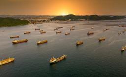
In addition to supporting us in daily decisions, weather forecasting is currently crucial in essential activities such as agriculture, aviation, navigation, port operations and civil defense, with the issuance of disaster risk alerts.
But after all, how are sea and weather forecasts made?
How a weather forecast is generated?
Atmospheric forecasts and ocean forecasts are generated in supercomputers, through computational codes that reproduce an approximate version of reality, known as numerical models.
Numerical models use real data of air temperature, rainfall, winds, waves, among others, to solve complex mathematical equations that describe the behavior of oceanic and atmospheric phenomena and the interaction between them.
As a result, we get predictions of what will happen to the sea and weather in the coming days. That is, the sea and weather forecasts that we see on a daily basis whether on television, radio, websites and applications are the result of processing these numerical models.
It takes a lot of science, technological infrastructure and computing power to get the right data and information to generate a good forecast in a timely manner. And obtaining forecasts goes through 3 basic steps:
1. OBSERVATION: What is the weather’s condition now? 2. FORECAST: What will the weather be like in the coming days? 3. COMMUNICATION: Dissemination of information.
1. What is the weather’s condition right now?
Forecasting begins with observing the current state of the atmosphere and ocean.
A complete picture of current environmental conditions is needed to establish the numerical model initial condition - the starting point.
These observations are made by instruments equipped with sensors that measure a range of weather conditions around the world. Like satellites, weather stations, ocean buoys, weather balloons, flow meters, aircraft and radars.
The quality of the forecast is totally dependent on the weather condition that the model is started, being defined in meteorology as an “initial condition problem”. The greater the amount of data and the more accurate it is, the better.
2. What will the weather be like over the next few days?
Models that have already been tested and calibrated then use this information to solve a large number of complex equations for various locations on the land and ocean surface and in different layers of the atmosphere.
This allows meteorologists and oceanographers to simulate how the ocean and atmosphere are currently behaving and predict what will happen in the coming days.
A curious fact is that atmospheric and oceanic phenomena are chaotic in nature, so small deviations in the first hours of the forecast can result in large errors days ahead. That’s why the forecast for today is much more accurate than the forecast for tomorrow, and the more days ahead, the harder it is.
The results of these models are analyzed and then generate global sea and weather forecasts that aims to represent oceanic and atmospheric events around the entire globe.
3. Communicate the weather forecast
Once the forecast is complete, effectively communicating the information and understanding the impacts of weather events is just as important as the details of the forecast itself.
Global forecasts can be broadcast directly, like the forecasts we see on television, websites and free apps. And they can be used as input for generating forecasts with higher regional or local resolution with a large network of weather forecasts around the world, such as i4cast®, i4sea's hyperlocal forecasting model.
Who is responsible for running the global weather forecasts?
Only a few large national or regional government institutions have the structure necessary to generate forecasts on a global scale – with satellites and other sensors distributed around the globe, supercomputers and a large team.
Some examples of these institutions are NOAA in the United States, ECMWF in Europe and CPTEC/INPE in Brazil.
While these models are all based on the same physics, some models may prioritize certain types of settings or data – such as wind speed, temperature and humidity – over others, generating predictions in a different way than another model.
That’s why two models can produce slightly different results, even with exactly the same initial observations.
We have seen this in practice when we have accessed different free forecasting sites that use different global models and we have noticed some differences between the forecasts. And, as a rule, we are left with the question: which will be more accurate?
We observed this in practice when we accessed free forecast websites that use different global models and noticed some variations between forecasts. Usually when this happens we are left with the question: which of these predictions is more reliable?
We continue this subject in the post discussing which forecast is the best one.